File:Tunisia adm location map.svg

Original file (SVG file, nominally 378 × 743 pixels, file size: 162 KB)
Summary
| Description |
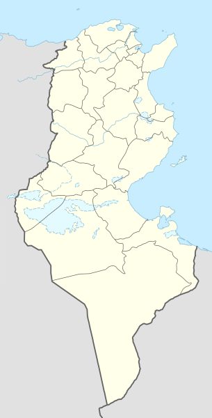
Deutsch: Positionskarte von Tunesien
English: Location map of Tunisia
|
||||||||||||
| Date | |||||||||||||
| Source |
Own work using:
|
||||||||||||
| Author | NordNordWest | ||||||||||||

|
This map has been made or improved in the German Kartenwerkstatt (Map Lab). You can propose maps to improve as well.
|
Licensing
Usage of this file with:

explanatory notes: Legally binding is only the full legalcode. For a free usage I recommend to respect the following licence conditions:
1. Provide my name as given above: NordNordWest,
2. a copy of, or the URI for, the applicable license: https://creativecommons.org/licenses/by-sa/3.0/de/legalcode,
3. the title of the work,
4. in the case of an adaptation, a credit identifying the use of the work in the adaptation.
This license and the rights granted hereunder will terminate automatically upon any breach by you of the terms of this license. Any of the above conditions can be waived if you get permission from the copyright holder. If you have questions or wish differing conditions, please contact me through nnwest or my discussion page ![]() t-online.de
t-online.de
- You make free:
- to share – to copy, distribute de transmit de work
- to remix – to adapt de work
- Under de following conditions:
- attribution – You for give appropriate credit, provide link to de license, den indicate if dem make changes. You fi do so for any reasonable manner insyd, but no be any way wey dey suggest de licensor dey endorse you anaa your use.
- share alike – If you remix, transform, or build upon de material, you fi distribute your contributions under de same anaa compatible license as de original.

File history
Click date/time top so say you go view de file as e appear for dat time.
| Date/Time | Thumbnail | Dimensions | User | Comment | |
|---|---|---|---|---|---|
| current | 12:03, 24 March 2024 | | 378 × 743 (162 KB) | GrandEscogriffe | more correct north-south stretching |
| 15:59, 9 November 2014 |  | 378 × 713 (146 KB) | NordNordWest | == {{int:filedesc}} == {{Information |Description= {{de|1=Positionskarte von Tunesien}} {{en|1=Location map of Tunisia}} {{Location map series N |stretching=115 |top=37.7 |bottom=30.0 |left=7.2 |right=11.9 }} |Source={{Own using}} * United States Natio... |
File usage
De following 3 pages use dis file:
Global file usage
De following oda wikis dey use dis file:
- Usage for af.wikipedia.org top
- Usage for am.wikipedia.org top
- Usage for an.wikipedia.org top
- Usage for ar.wikipedia.org top
- عروج بربروس
- الرابطة التونسية المحترفة الأولى
- كأس الأمم الإفريقية 2004
- قائمة مطارات تونس
- كأس الأمم الإفريقية 1994
- النادي الإفريقي
- قالب:خريطة مدن تونس
- قالب:خارطة جبال تونس
- قالب:خريطة مواقع تونس
- كأس الأمم الإفريقية 1965
- قائمة مدن تونس المتوأمة
- بطولة أمم إفريقيا لكرة السلة 2015
- قالب:خريطة مواقع التراث العالمي في تونس
- قائمة مواقع التراث العالمي في تونس
- قالب:ص.م/موقع جغرافي مضاعف
- قالب:ص.م/موقع جغرافي مضاعف/شرح
- بوابة:التراث العالمي/خريطة مختارة
- الرابطة التونسية المحترفة الأولى 2015–16
- بطولة إفريقيا لكرة اليد للرجال 2020
- بطولة أمم إفريقيا لكرة السلة 2017
- الرابطة التونسية المحترفة الأولى 2016–17
- الرابطة التونسية المحترفة الأولى 2017–18
- الرابطة التونسية المحترفة الأولى 2018–19
- كلاسيكو تونس
- ديربي تونس الصغير
- الحي الوطني الرياضي
- الرابطة التونسية المحترفة الأولى 2019–20
- وادي الساقي
- وادي سيدي صالح
- الرابطة التونسية المحترفة الأولى 2020–21
- دورة تونس للأمم الأربعة 2003
- وحدة:Location map/data/تونس
- وحدة:Location map/data/تونس/شرح
- كأس إل جي الدولية 1997 (تونس)
- كأس إل جي الدولية 2006 (تونس)
- الرابطة التونسية المحترفة الأولى 2021–22
- بطولة إفريقيا لكرة اليد للرجال 2006
- الرابطة التونسية المحترفة الأولى 2022–23
- جبال تبسة
View more global usage giv dis file.